The Main Stem of the Amazon River
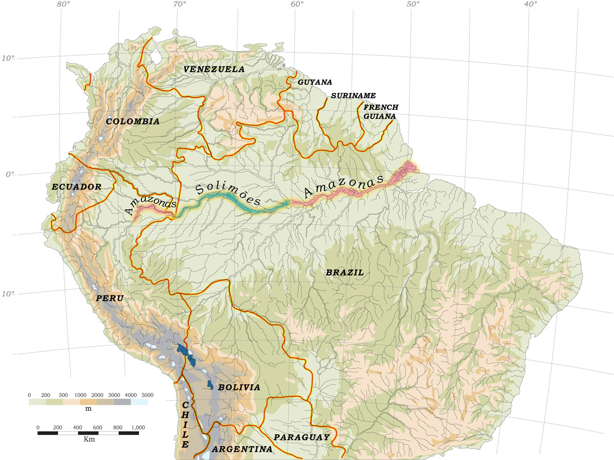
Map of Amazon River Main Stem.
The Amazon River courses through three countries but does not maintain a single name for its entire length. It is identified on most maps as, beginning upstream, the Amazonas (Peru), the Solimões (Brazil) and the Amazonas (Brazil). Geographers sometimes consider the Ucayali River in Peru also to be part of the Amazon River because the Amazon’s farthest headwaters are found there. South Americans often use the terms “rio Amazonas” (Portuguese) or “río Amazonas” (Spanish) to mean the Amazonas-Solimões-Amazonas. Following this definition, the river, starting upriver, is mostly oriented west to east-northeast and courses through five degrees of latitude before emptying into the Atlantic just north of the equator.
The Amazon River—from the confluence of the Ucayali and Marañón Rivers in Peru to the Atlantic—is approximately 3,750 km long. The channel and floodplain of the river occupy more than 100,000 km2. More than 80 percent of the river is in Brazil, 18 percent is exclusively in Peru and approximately 2 percent is shared between Peru and Colombia. Humans have used the Amazon River floodplain for at least 11,730 years—the age of the oldest known archaeological sites associated with the main river. Some anthropologists and geographers have argued that relatively dense populations lived along the Amazon River in pre-Columbian times. It has even been suggested that indigenous populations were, at times, larger than the rural populations now living on the floodplains. The extent to which Indians modified the Amazon floodplain is not clear, but deforestation at any given time probably never reached present-day proportions. Large parts of the Amazon River floodplain might have been gradually modified during the past 10,000 or more years, but at any given time in history most of the floodplain forest was relatively natural although by no means pristine.
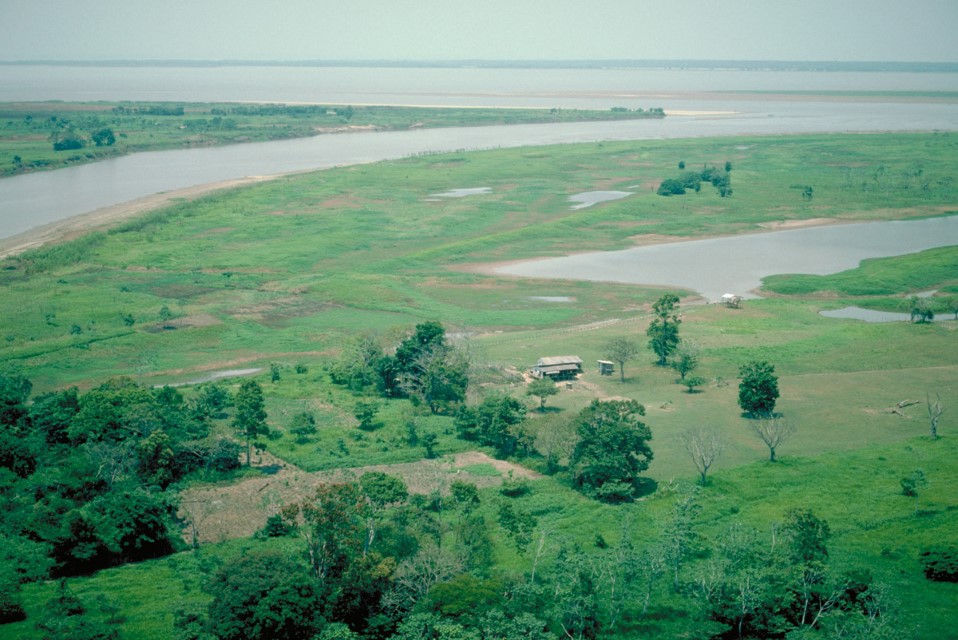
Department – Country: Pará – Brazil Main Basin – Sub Basin: Amazon Main Stem – Eastern Amazon Main Stem Photographer: Michael Goulding
The ecology of the Amazon River is obviously closely linked to that of its tributaries. The extent of the main stem across most of north-central South America, its central geographical position in the Amazon Basin and the unmatched size of its floodplains contribute to its ecological complexity. Because the Amazon River is the main artery for urbanization, commerce, transportation, fisheries and floodplain agriculture, its floodplains have also been modified more than those of any of its large tributaries, with the possible exception of those of the Tocantins River. Most proposed large-scale floodplain agricultural projects are aimed at the Amazon River floodplain because of its size, fertile soils and proximity to major urban centers. The Amazon River floodplain is molded by annual deposition and erosion cycles. Although not as unstable as Peruvian river floodplains such as those of the Ucayali, the Amazon’s floodplain is nevertheless constantly undergoing morphological changes. For example, the erosion of floodplain banks reintroduces a quantity of sediments greater than the quantity of net sediment flux that flows past Óbidos, approximately 900 km upstream of the Atlantic. Some floodplain areas, however, are very broad, often exceeding 20 km and may undergo only slight morphological changes, even over a century. Deforestation and floating meadow destruction appear to be leading to greater floodplain instability along the Amazon River.
How to protect the Amazon and its aquatic ecosystems? We recommend you to read A guide to save the Amazon Basin (in Spanish)
-
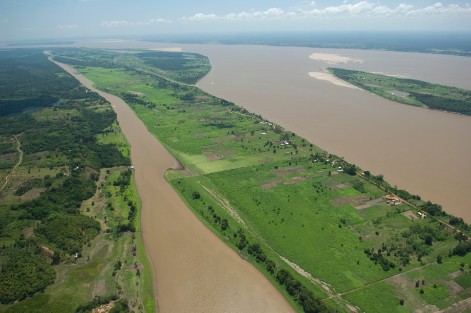
Canal principal 1
Amazon River and its floodplain just west of Manaus. Department – Country: Amazonas – Brazil Main Basin – Sub Basin: Amazon Main Stem – Central Amazon Main Stem Photographer: Luiz Claudio Marigo
-
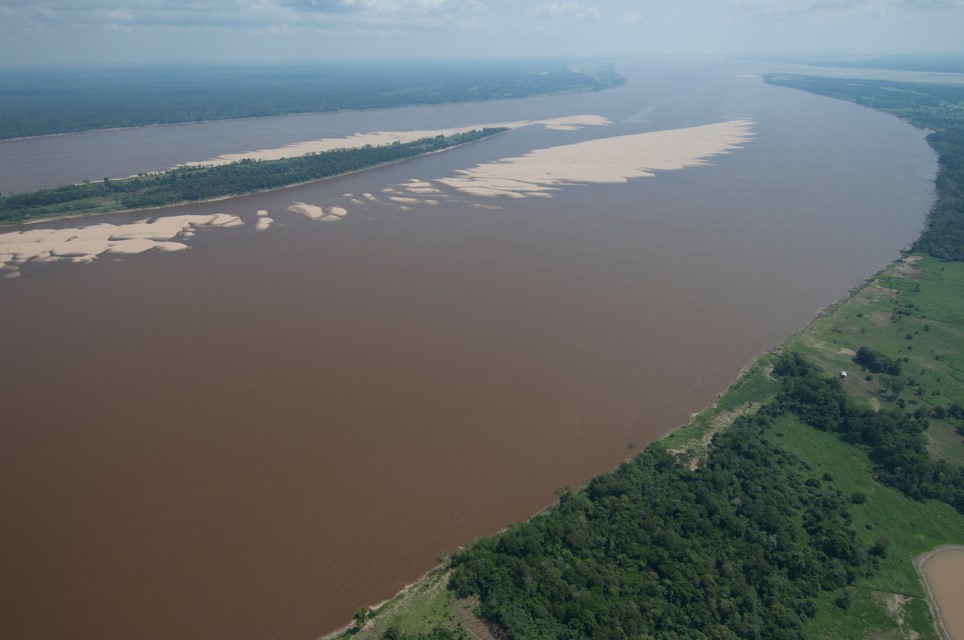
Canal principal 2
Amazon River downriver of the Negro River. Department – Country: Amazonas – Brazil Main Basin – Sub Basin: Amazon Main Stem – Eastern Amazon Main Stem Photographer: Luiz Claudio Marigo
-
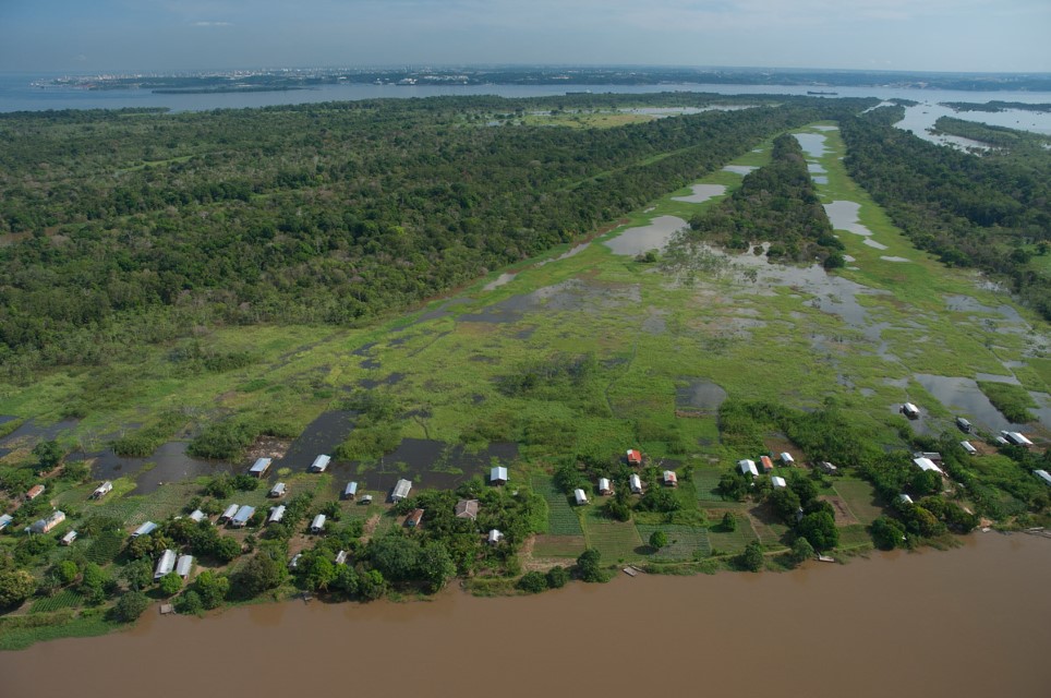
Canal principal 3
Human settlement on the Amazon River floodplain. Department – Country: Amazonas – Brazil Main Basin – Sub Basin: Amazon Main Stem – Eastern Amazon Main Stem Photographer: Luiz Claudio Marigo
-
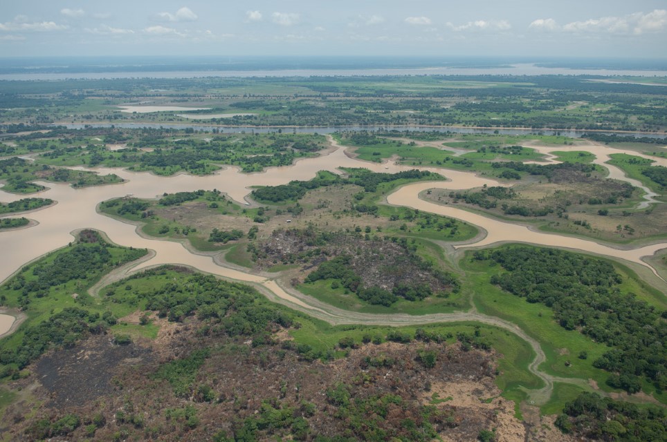
Canal principal 4
Department – Country: Amazonas – Brazil Main Basin – Sub Basin: Amazon Main Stem – Eastern Amazon Main Stem Photographer: Luiz Claudio Marigo
-
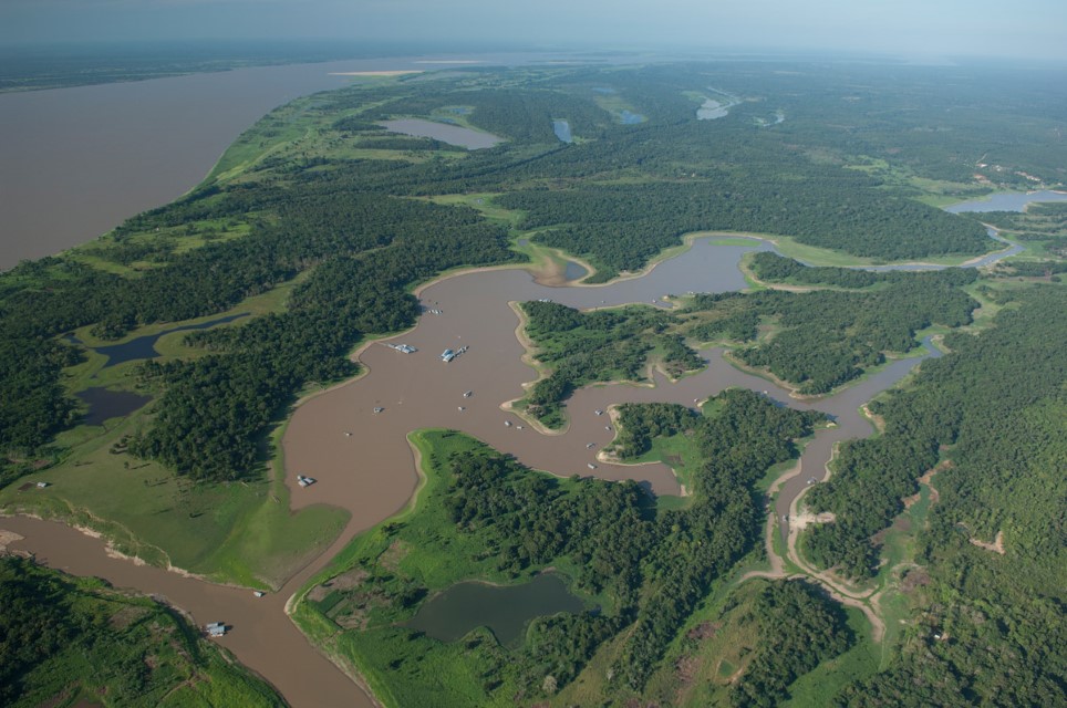
Canal principal 5
Department – Country: Amazonas – Brazil Main Basin – Sub Basin: Negro – Lower Negro Main Stem Photographer: Luiz Claudio Marigo
-
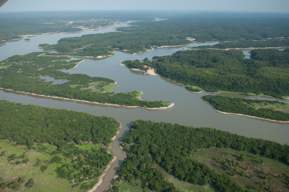
Canal principal 6
Department – Country: Amazonas – Brazil Main Basin – Sub Basin: Amazon Main Stem – Eastern Amazon Main Stem Photographer: Luiz Claudio Marigo
