The Tocantins is the easternmost large triburary in the Amazon Basin. With more than 750,000 km2, the Tocantins Basin is more than twice the size of Ecuador and larger than France. It is the largest river valley restricted to one country in the Amazon Basin.
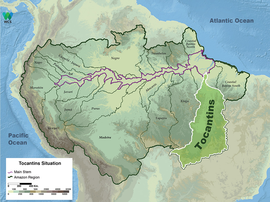
The three significant wetland features of the Tocantins Basin are the huge river-mouth, Tucuruí Reservoir and Bananal Island. The lower 150 km of the Tocantins River is a giant mouth-bay heavily influenced by oceanic tides. Some scientists do not consider the Tocantins to be part of the Amazon Basin because it does not discharge directly into the Amazon River, but rather into the Pará River south of Marajó Island. Amazon River waters, however, also discharge into the Pará River via The Breves Channel around western Marajó Island. The Tocantins debouches into a mixture of Amazon and Pará waters and thus could technically be considered part of the Amazon Basin. More importantly, the ecology of the lower Tocantins River is directly linked to that of the Amazon River mouth region.
The fauna and flora of the lower Tocantins are closely related to Amazonian species. The Tocantins flows so far south, however, that its headwaters are more than 3,000 km from Marajó Bay. The river’s headwaters are just south of Brasília in the Cerrado, the scrub-savanna region of Central Brazil. The Tocantins Basin is the only river valley in the Brazilian Amazon whose drainage encompasses more than three states. The largest of those is Tocantins, a relatively new state founded in 1989, whose capital is Palmas. The Tocantins River has only one large tributary, the Araguaia. In the middle stretch of the Araguaia River is Bananal, one of the largest scrub-savanna wetlands in the Amazon Basin. Most of the Tocantins Basin is outside of the Amazon rainforest because annual precipitation is less than 1,500 mm. Many Amazonian species, however, live in and along rivers and streams deep in the central Brazilian Cerrado.
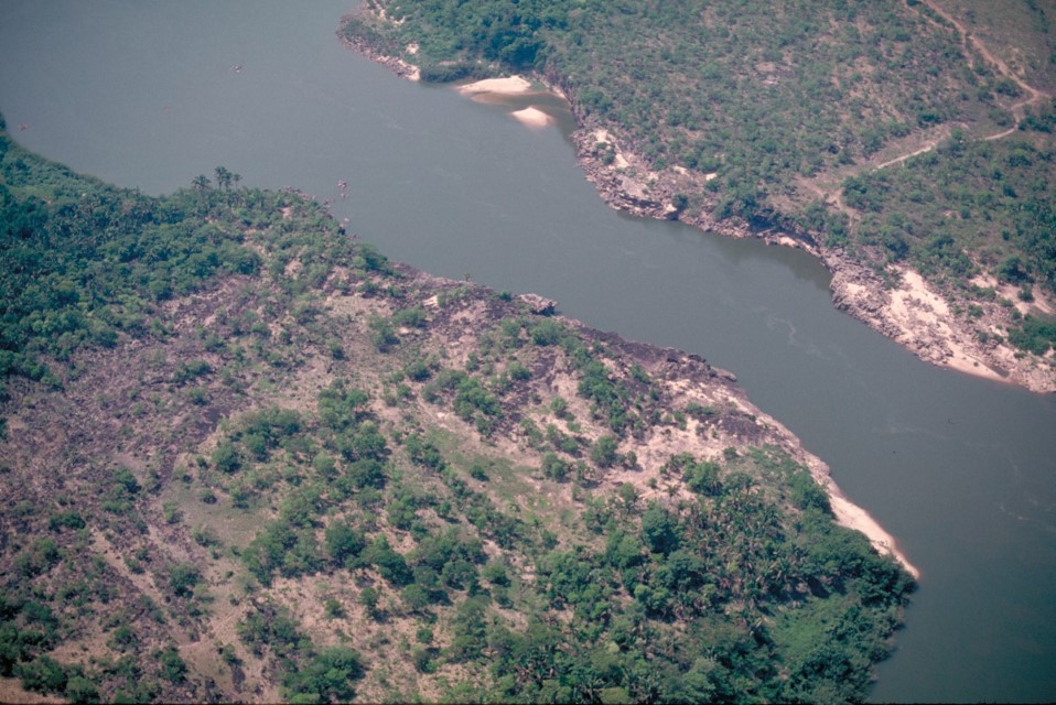
Middle Tocantins River. Department – Country: Amazonas – Brazil Main Basin – Sub Basin: Negro – Lower Negro Main Stem Photographer: Michael Goulding
Protected Areas
Araguaia National Park, which now covers the northern third of Bananal Island, was the first national park decreed in the Brazilian Amazon. It is the only major conservation unit protecting wetlands in the Tocantins Basin and is probably Brazil’s best hope for protecting wildlife associated with savanna wetlands. There are also relatively large contiguous indigenous areas near the Araguaia National Park.
Uses & Impacts
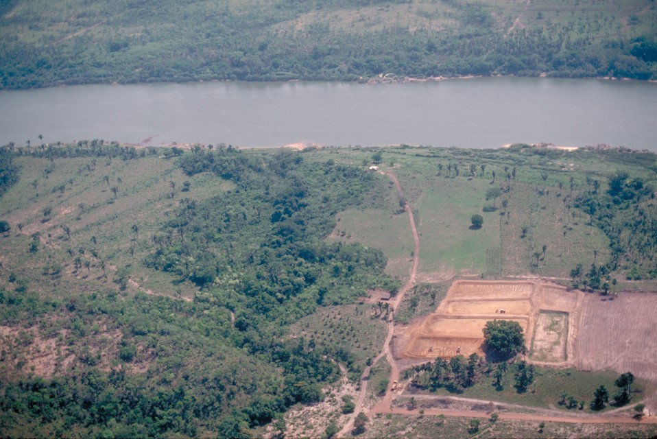
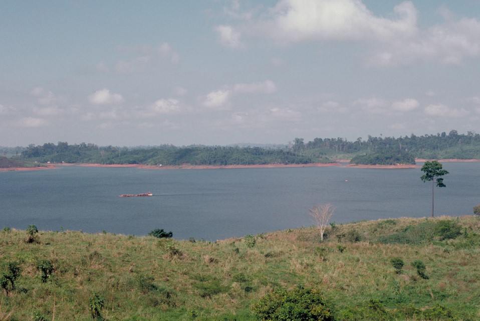
The Tocantins River is the most heavily modified large tributary of the Amazon Basin. By the early 1970s, the Belém-Brasília and Trans-Amazonian highways opened the Tocantins Basin to large-scale development. Cattle ranching expanded along the major highways and led to extensive deforestation in the states of Goiás, Tocantins and Pará. In the 1990s the soybean-farming frontier pushed north into the Cerrado and rainforest areas of Goiás and Tocantins states. The largest high-grade iron ore deposits in the world are in the Carajás region in the Itacaiunas sub-basin in the lower Tocantins Basin. Manganese, copper, gold and other minerals are also exploited in the Carajás region. Manganese and copper mined in the region are transported by rail to the port of Itaqui near São Luís in the state of Maranhão. The Itacaiunas River is the main tributary that drains the Carajás region. Gold mining significantly impacted the river in the 1980s and though better organized now, still continues to impact local streams. The highly organized iron-ore operations, however, appear to have had little impact on the ecology of the Itacaiunas.
The giant mouth-bay of the Rio Tocantins supports many pelagic fish species, including commercially important plankton-feeding mapará catfish (Hypophthalmus spp.). These species have been heavily targeted for the Belém market since the 1950s. The mapará fishery in the mouth-bay declined drastically after Tucuruí Dam was completed in 1988. The factors that caused the fishery to crash are not clearly known. Two possibilities are the disturbance of spawning areas near the dam and a lack of nutrients or plankton. The fisheries eventually recovered though they continue to face overexploitation.
Bananal Island is a low-lying island 400 km long and up to 120 km wide between two channels of the Araguaia River. The Island covers approximately 20,000 km2 of a much larger low-lying floodable region of perhaps 40,000 km2. The Island’s terrain is very flat and subject to flooding every year for about 6 months during the rainy season. This large river island has been used for cattle ranching for more than a century. During recent decades indigenous peoples have also begun to raise cattle on the Island. Cattle and water buffalo are now found on most of the Island, although the northern part of Bananal is a national park. With approximately 100 lakes, Bananal Island supports commercial and sport fishing. Ecotourism on the Island has blossomed in the past decades. Despite the size of Bananal’s wetlands, there have been relatively few studies of the ecology of the giant river island and its role in the Tocantins Basin.
At present the Tocantins Basin produces more hydroelectric energy than any other basin in the Amazon. More than 20 dams have been planned for the Tocantins and Araguaia Rivers, and there already exists an enormous electrical distribution network that serves not only the eastern and central Amazon Basin of Brazil but also northeastern and central Brazil. Tucuruí Dam was the first major dam constructed on a large river in the Amazon. The energy produced by the dam spurred economic development in the state of Pará and Tocantins, although it was insufficient to satisfy rapidly growing urban and industrial demands in the 1990s. More turbines have been added to the dam to boost energy capacity. The new Lajeado Dam on the Tocantins River produces energy for the Palmas region in the state of Tocantins. Farther upstream the Serra da Mesa Dam in the state of Goiás supplies the immediate region and Brasília in the Federal District.
The ultimate impact that dams will have on the Tocantins and Araguaia will largely depend on how many are constructed and how much crucial wetland is conserved between them. The Tucuruí, Lajeado and Serra da Mesa Dams are at least 300 km apart from one another. Tucuruí Dam was constructed without any major study of the potential effects on migratory fish species or of its impacts beyond the immediate region of the impoundment. It appears that the dam prevented some migratory species from moving upstream but this appears to have had little impact on commercial fisheries. Upriver of Tucuruí Dam, biomass of commercially valuable fish increased tenfold in the decade after the dam was constructed. Commercially, the most valuable fish living in Tucurí Reservoir are plankton-feeding mapará catfish. The large numbers of pelagic prey available in the reservoir allowed predatory fish populations, such as peacock bass (Cichla spp.) and croakers (Plagioscion spp.), to increase significantly. Some long-distance migratory species, such as curimatá (Prochilodus sp.), adapted to the new reservoir and use it as a nursery, migrating upstream at the beginning of the floods to spawn where the river channel is still more or less natural.
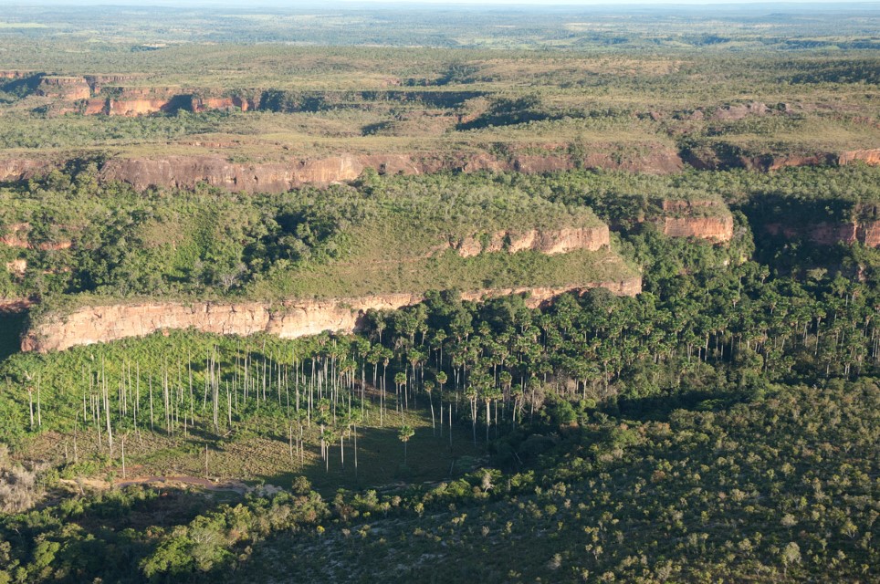
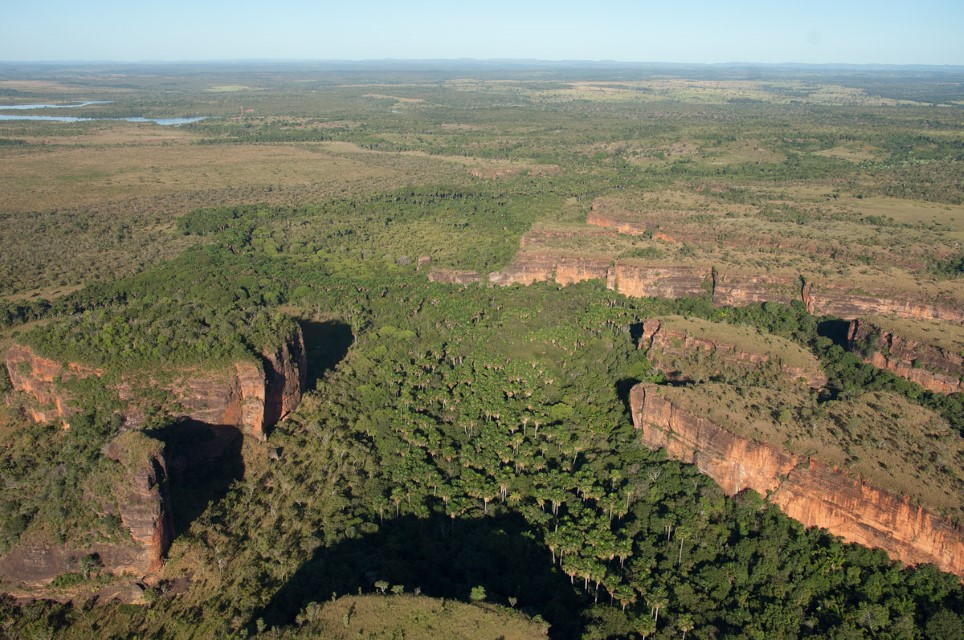
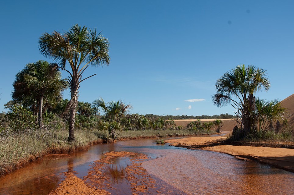
The Cerrado region of Central Brazil covers much of the headwater regions of the Tocantins, Xingu and Tapajós Rivers. In the past four to five decades thousands of streams have been destroyed in the region as the cattle ranching and agricultural frontiers advanced northward. Once riparian forest is destroyed, streams are subject to complete desiccation during the dry season. One of the characteristic aquatic habitats of the cerrado region is buriti (Mauritia flexuosa) palm swamp, which occupies low-lying areas along streams. Hundreds of shade-loving animal species depend on these aquatic forests in an otherwise precarious desert-like environment during the dry season. Palm swamps are rapidly disappearing due to stream impoundment, brush fires in exceptionally dry years and aggressive deforestation of riparian vegetation. Urgent regulations are needed to preserve at least riparian forest in large-scale agricultural areas not only for terrestrial and aquatic wildlife but also to help maintain water quality.
Large and small dams, mining, cattle ranching, road construction and large-scale crop farming such as for soybeans will continue to transform the Tocantins Basin. Industries will be attracted as hydroelectric projects make more energy available. A functional interstate river basin commission has yet to be fully implemented to assess the long-term and far-reaching consequences of headwater deforestation, dam construction, pesticide pollution and other activities that can cause significant downstream impacts. As development continues, most of the middle and upper Tocantins Basin will gradually be transformed into a drier, non-forested landscape.
-
Tocantins 1
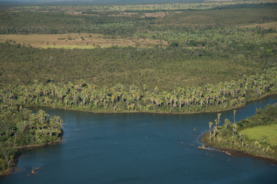
Tocantins River with bordering Attalea palms. Photographer: Luiz Claudio Marigo
-
Tocantins 2
Palm (Mauritia flexuosa) gallery swamp in the Brazilian Cerrado of the Tocantins Basin. Photographer: Luiz Claudio Marigo
-
Tocantins 3
Palm (Mauritia flexuosa) gallery swamp in the Brazilian Cerrado of the Tocantins Basin. Photographer: Luiz Claudio Marigo
-
Tocantins 5
Settlement along the middle Tocantins River. Department – Country: Amazonas – Brazil Main Basin – Sub Basin: Negro – Lower Negro Main Stem Photographer: Michael Goulding
-
Tocantins 6
Cattle ranching along the middle Tocantins River. Department – Country: Amazonas – Brazil Main Basin – Sub Basin: Negro – Lower Negro Main Stem Photographer: Michael Goulding
-
Tocantins 7
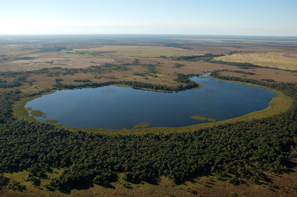
Lake-like water body in dry region of the Tocantins Basin. Main Basin – Sub Basin: Tocantins Photographer: Luiz Claudio Marigo
-
Tocantins 8
Stream in State Park of Jalapão in the Cerrado Region. Elevation: Tocantins Photographer: Luiz Claudio Marigo
-
Tocantins 9
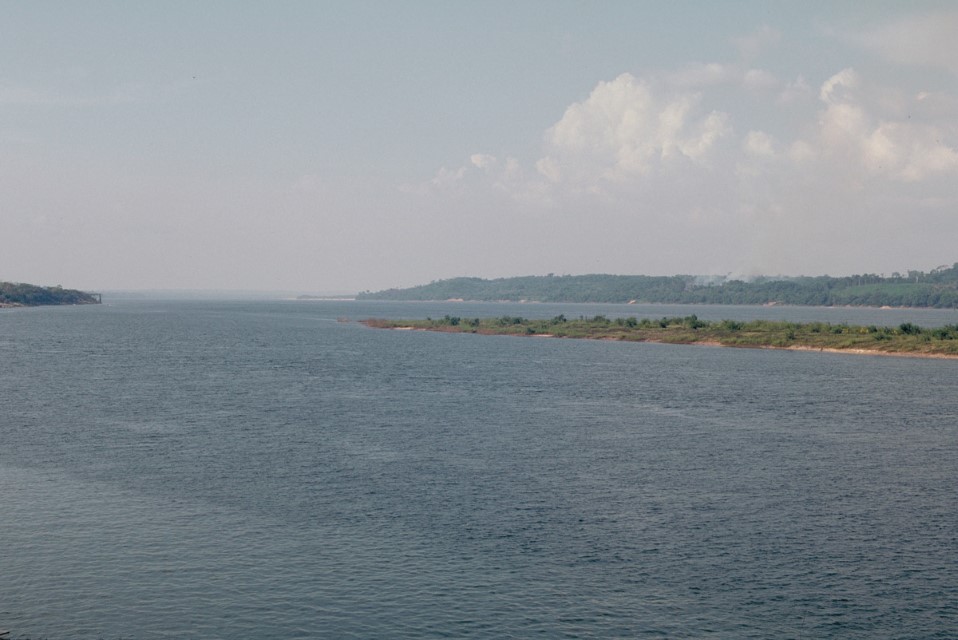
Department – Country: Amazonas – Brazil Main Basin – Sub Basin: Negro – Lower Negro Main Stem Photographer: Michael Goulding
MAIN RIVER BASINS
Caquetá-Japurá
Juruá
Madeira
Marañón
Napo
Negro
Purus
Putumayo-Içá
Tapajós
Tocantins
Trombetas
Ucayali
Xingu
