
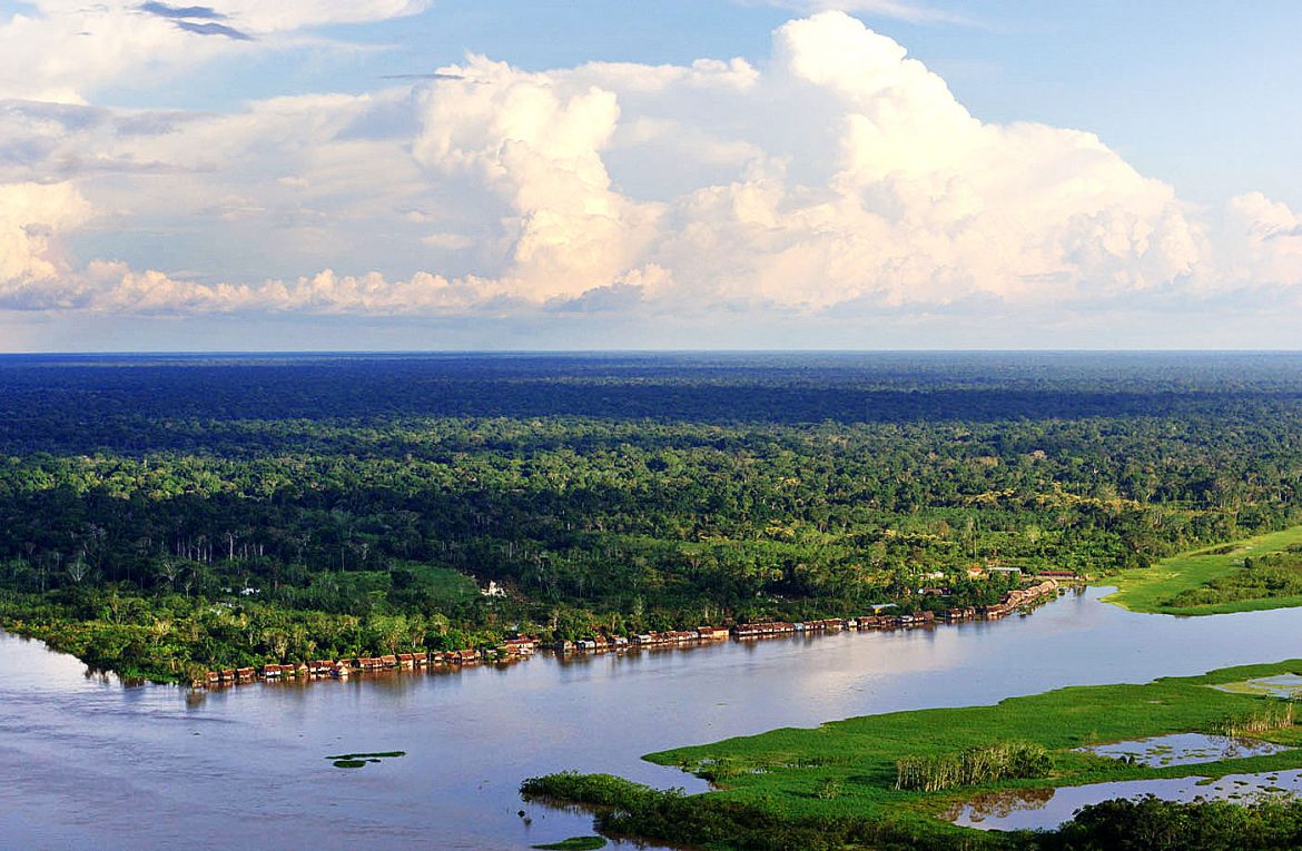

Wetlands are flooded land areas. In the rainy seasons, water is usually plentiful there, but its level decreases when drought season arrives. Photo: Walter Wust. Cananguchal, lagoon, pool, swamp, madrevieja, reservoir, estuary, and peatland are some of the most well-known names for wetlands; land areas flooded with water and found in rural areas, on the coasts or in large cities, many of them with the naked eye. They are the most productive ecosystems in the world as many species of plants, animals, and microorganisms that nourish the soils inhabit there make growing food, water availability, or biodiversity conservation possible, for example. Common wetland settings are those in which an abundance of birds and insects are seen flying over the body of water, while there are frogs, turtles, or alligators on land. In other places, fishermen’s canoes are seen stopping to fish at certain points in the course of the water. Likewise, those boats used for the transportation of people, food, construction materials, or household appliances may be seen. Other places are the large areas where rice is grown. They all have wetlands as a common setting.
Brazil is recognized worldwide for being the most megadiverse country in the world, as well as for its water reserves, including numerous wetlands. Currently, the country has 27 wetlands of international importance Ramsar sites
(wetlands that are of great international value due to their ecological characteristics), nine of them are located in the Amazon Basin, which is the world’s largest freshwater basin and rainforest. These wetlands are important for the country and the Amazon region because of their interconnection, thus contributing to the preservation and conservation of the basin, and the ecological connectivity of the protected areas that comprise them.
In 2018, wetlands of the Negro and Juruá Rivers were declared as Ramsar Sites, the first ones on a regional scale, where conservation and governance processes have been underway for various years with the participation of local and regional communities and governments, civil society associations, NGOs, and the national government, as there are already some protected areas. The Ramsar Sites designation on a regional scale represents a challenge for consolidating a governance model that integrates the multiple actors in these regions, gives continuity, and strengthens the processes already underway.
Ramsar sites por Conservation
Until 2017, Brazil had been one of the countries in the world that recognized Ramsar Sites only if they coincided with protected areas (conservation units). The reason for this was that in such an extensive territory (Brazil is the fifth largest country in the world) it was necessary to optimize the few economic and technical resources, and the limited number of people for the administration of protected areas and Ramsar Sites at the same time. However, considering their importance as one of the countries with areas with the greatest catchment of freshwater, its biodiversity to maintain the natural balance of the planet, and growing threats such as the degradation and fragmentation of ecosystems (due to the land conversion, deforestation, illegal logging, and overexploitation of resources), the country decided to expand Ramsar Sites to wetlands that are not necessarily protected areas restricted to conservation, such as indigenous lands, permanent preservation areas along rivers, etc. The objective: to ensure ecological connectivity (especially of freshwater ecosystems) and territory conservation on a regional scale. Since then, the country has had Ramsar wetlands made up of both protected and unprotected areas, but of ecological importance, including the Negro and Juruá Rivers. It should be noted that in Brazil, protected areas are divided into two large categories, such as those for comprehensive protection, which seek long-term in situ conservation of biological diversity, and those for sustainable use that are areas where the sustainable use of natural resources takes place.
The designation of Ramsar sites contributes to the consolidation of national or international cooperation agreements to allocate financial or technical resources for their management and carrying out conservation projects.

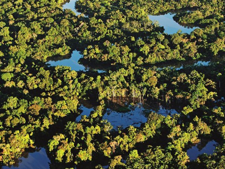
As of 2018, Brazil has designated wetlands that are not necessarily located within a protected area as Ramsar Sites, which allows for greater connectivity among these ecosystems at the regional level. Photo: Walter Wust.
Challenges: governance and communication
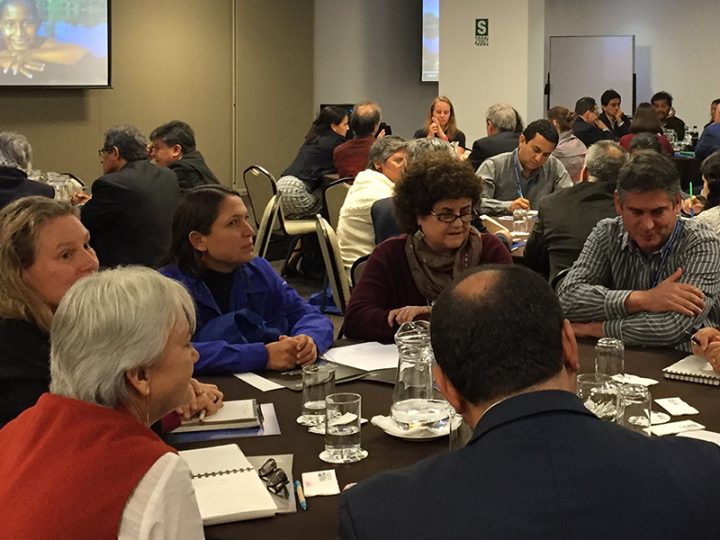
“Since the idea of declaring Ramsar Sites that do not necessarily correspond to protected areas arose, one of the greatest challenges has been to build a single management and governance system under this Ramsar designation in regions of such magnitude, not only because of their geographical extension, but also because of the multiplicity of actors, interests, needs for use and conservation, and already existing governance initiatives in each protected area,” states Carlos Durigan, Director of WCS Brazil. This single management and governance system must be representative of all actors and their needs, and ensure the participation of the vast majority of people since the objective is to ensure not only environmental conservation but also the quality of life of local communities.
According to Guillermo Estupiñán, a specialist in fisheries resources at WCS Brazil, “Negro River, for example, is a 12-million-hectare region where more than 2 million people live, so a strong representation implies another challenge: communication.” What a Ramsar Site is, how a Ramsar Site is managed, what the most appropriate practices for the sustainable use of natural resources for its conservation are, what needs to be strictly conserved, what can be harnessed, and how to do it, or how to manage a large region to ensure the conservation of biodiversity are some of the issues that need to be communicated to local communities (indigenous, Afro-descendant, and riverside dwellers), both rural and urban, in order to consolidate the governance model, which is the first step to take for the management of these Ramsar Sites.
It should be highlighted that this process did not start from scratch. Already existing management and governance systems and management plans for many protected areas have been an opportunity to disseminate these experiences and knowledge to other territories that, without being protected areas, are part of the Ramsar Sites. The Negro River Network and the Territorio Médio Juruá Forum are two networks or associations that already existed before the Ramsar designation, and now are focal points among the different actors involved in the management of Negro and Juruá Rivers (local communities, governments, NGOs, productive associations, civil society organizations, and the Ramsar Convention). Since 2018, these associations have first supported communication and articulation actions, despite the limitations due to the COVID-19 pandemic and changes in the country’s environmental policies.

An opportunity for the management of Negro and Juruá Rivers is the already existing management and governance systems, as well as management plans for many protected areas. Photo: Walter Wust.
Over the last two years, especially in 2020, progress has been made through specific actions to achieve the participation of the greatest number of people and institutions in the construction of the governance system of Ramsar Sites. The most immediate challenge is seeking funds through the government or cooperation funds to boost the process. “In the country, there are no precedents on how to consolidate a single governance system for Ramsar Sites, so the main concern is to achieve this governance model for the Negro and Juruá Rivers (and other Ramsar Sites of such magnitude),” explains Carlos Durigan. The priority is to develop face-to-face participation processes with local communities once it is possible to return to the territories (many of which are difficult to access), in order to identify those actors and management proposals that can make up the governance system (which would be made up of a steering committee and several committees responsible for specific matters), and then move forward to design the communication network.
The strengthening of the fishing production chain, the design of methodologies, and projects for fundraising; the strengthening of community tourism or payment for the environmental services provided by the communities are some actions put forward so far as part of the Negro and Juruá Rivers management plans for the future. At this time, the management of Juruá and Negro Rivers is in an embryonic phase. However, achieving a single management block for each one will be an important strength, since although they are regions in a good state of conservation, “it is necessary to create a setting in which sustainable resource management projects can be carried out and promote a new development culture that takes into account conservation as a sufficient reason not to intervene in these territories with practices that may lead to their deterioration. In regards to the Negro and Juruá Rivers, there are many opportunities in the governance experiences and the social capital created for conservation,” says Carlos Durigan.
A quick look at the wetlands
Negro river

Main channel of the lower Negro river basin. Photo: Luiz Claudio Marigo
The Negro river basin is located in the State of Amazonas, in northwestern Brazil, in one of the most conserved regions of the Brazilian Amazon. The Negro river Ramsar site covers a 12-million-hectare area (similar to that in Nicaragua) and is the largest in the world in this category. The site includes more than 20 protected areas, many of which are indigenous lands where there are important archaeological sites. With great natural and cultural wealth, part of the Negro River territory is within the Central Amazon Biosphere Reserve and is a UNESCO Natural Heritage Site.
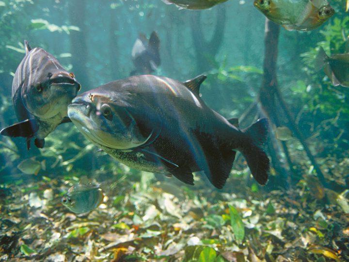
The biological importance of this Ramsar Site as a high endemism area is explained by its types of wetlands: the forests flooded by black water rivers (igapós) and the campinas and campiranas that are large extensions of white sand savannas, unique in the northern Amazon. These wetlands are the habitat of many aquatic fauna and flora species (palm trees and tropical trees adapted to long flooding periods) that only exist there and nowhere else on the planet (endemic species), and of a fish diversity considered one of the largest in the world (approximately 1,100 species), many of which participate in the great migrations throughout the Amazon Basin. Among these migratory fish are the piraiba,
the largest catfish in South America, and the golden catfish, whose journey exceeds 11,600 kilometers. The Negro River is also the habitat of threatened species such as the giant river otter (the largest in the world and about two meters long), the pied tamarin, the Amazon river dolphin, the manatee, and the white-bellied spider monkey; in addition to globally threatened birds such as the ash-breasted antbird ant, and plants such as the Brazil nut.
At local, regional, and global levels, thanks to the high rates of precipitation (rains) there, the area of the Negro River has the highest freshwater catchment. Many indigenous peoples who live in the upper Amazon Basin and at least six municipalities in Brazil are supplied with their water. The river is also the main means of transportation and connection among the cities and municipalities in the region.
It should be noted that Negro River is, in part, a region whose natural wealth results from ancient indigenous practices (dating from at least 10,000 years ago) that contributed to the transformation of soils that were poor in nutrients (essential for the development of plant life) to fertile soils. Thanks to the “Indian black earth,” resulting from the transformation of ceramic remains and organic waste that the indigenous people deposited in specific places for their decomposition, diverse fauna and flora emerged that today characterizes Brazil as the most biodiverse country in the world.
Juruá river

Riparian forest on the Juruá River in Acre, Brazil. Photo: Walter Wust.
The Juruá river basin is located in the state of Amazonas, southwestern Brazil. The Ramsar site covers a 2.1-million-hectare area (similar to that in El Salvador) and is made up of three protected areas and one indigenous territory. Like the Negro River, the Juruá is also in the territory of the Central Amazon Biosphere Reserve. Its wetlands are flooded forests or várzea forests (typical of floodplains and along white water rivers of the Amazon), lakes that appear and disappear depending on the rainy season or summer, and abundant white-water rivers.
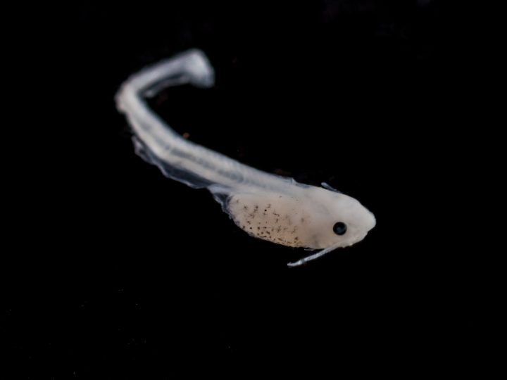
On a biological level, Juruá is an essential place for fish conservation (it is the habitat of 392 species of fish for food and commercial importance for human populations) thanks to the fact that its wetlands, rich in nutrients, offer food and serve as a nesting site for eggs deposited there by the females; as well as for the conservation of reptiles and mammals vulnerable to extinction such as the yellow-spotted Amazon river turtle, the loggerhead sea turtle or the six-tubercled Amazon River turtle, the Amazonian manatee, the giant armadillo, and the bald uakari. Juruá is also the habitat of one of the greatest wealth and diversity of amphibians, the giant anteater, the lowland tapir, and the white-lipped peccary; and it is the permanent home of numerous species of birds (the regions of Mamirauá and the upper Juruá river are important bird areas) and transitory migratory birds.
***
According to Alberto Chirif, the greatest expert on indigenous communities in Peru, governance is defined as “the interactions and agreements between governors and the governed for creating opportunities and solve citizens’ problems, as well as for building institutions and making rules necessary to create those changes.”
Written by Carolina Obregón Sánchez
Consulted sources:
- Carlos Durigan, Director WCS Brasil
- Guillermo Estupiñán, especialista de recursos pesqueros, WCS Brasil
- https://www.ramsar.org/es/humedal/brasil