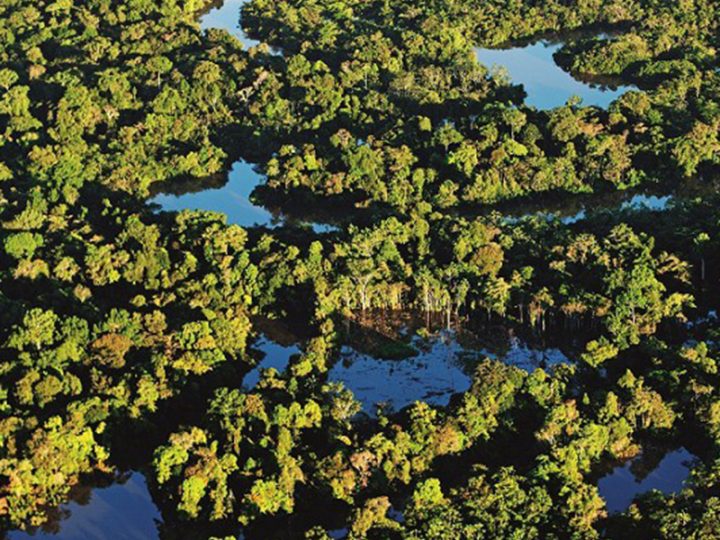

The Amazon basin continues to be one of the places with the least access to the Internet.
The Internet is a network of networks, a way of sending information across the world. This information is sent via wave signals (electricity, light, microwaves, radio waves, etc.), using standard protocols that allow receivers and users to interpret the wave signals. While the world is increasingly becoming connected with at least 4.6 billion people using the Internet, there are some places that are still remote. The Amazon rainforest is one of these places.
Why is the Amazon rainforest so hard to connect to the Internet? The fastest access to the Internet today comes from fiber optic cables that send information at the speed of light. These fragile cables were first invented in the 1980s, and have to be laid in expensive casings in order to protect them. So far, they have been mainly laid underwater to connect continents, where, once they reach the continent, the information will be relayed in some other way. As the heart of South America, the Amazon is among the furthest to reach from the fiber optic cables on the coasts, and there are few terrestrial networks reaching the basin (see map 1). To install these, it would take not only a large investment from both government and private companies, but a large amount of deforestation.
 Map from Infrapedia.com/app : Shows the cables connecting internet systems. Go to link for more detailed information.
At the same time, conservation efforts often need internet access to function. The Citizen Science for the Amazon Network is motivated by many of the same goals as the Amazon Waters Initiative, but aims to use citizen science to better understand migratory fishes and the factors that affect their migration. Yet, thus far, the data is concentrated in a few regions. Dr. Thiago Couto (Florida International University) and Guido Herrera (PhD Candidate, University of Tennessee) are leading the effort to map factors that could influence where the network will focus efforts. These factors are many: (1) Biological factors– Where do we need data samples to capture the complete life cycle of migratory fish? We need data from there; (2) Importance for fisheries– Where will fishers use the data and thus drive the data collection?; (3) Data factors –Where are the gaps and biases of current knowledge?; and finally, (4) Logistics– factors such as partner locations, and, maybe most importantly in a citizen science project that uses a mobile application, access to the Internet.
Instead, the best access to the Internet in the Amazon seems to come from cellular networks. Using publicly available data, Mr. Herrera created a map of accessibility of population to cellular towers with mobile internet (see below). Cellular networks are dependent on these towers, which have their own set of limits. For example, in non-forested areas, waves at the frequencies that cellular devices have a range of about 1 km, and they rely on antennas to pick it up and relay it at greater distances via connections to other antennas or to terrestrial electronic networks (copper wiring) or fiber optic cables. With the forest, this range can be much shorter. With estimates of population in the Amazon basin, Mr. Herrera estimated that about 27 million of the 55 million people that live in the basin (~48%) live within 1 km of a cellphone tower. Those that don’t, live either in peripheries of cities or in places with no large settlements.

Map created by Guido Herrera, University of Tennessee. The color of the landscape indicates how far away from a cellphone tower that part of the map is with white being very close to a cellphone tower, and green being very far away (see legend on right). The blue dots indicate major cities in the region. The basin is divided up into sub-basins.
How can we improve Internet access in the Amazon without deforesting? Google had been working on a project called “Loon” that would use hot air balloons to cover a wider range than cellular towers, and thus allowing better Internet access. However, with its closing in January 2021, the hopes of Internet access seem limited to satellite internet. Currently, mobile devices cannot reach satellites (although, with specialized satellite phones, people in the Amazon can reach the Internet), yet SpaceX (Starlink), Amazon (the company; Project Kuiper), and Beijing have been investing in satellite-broadband technology. These projects aim to create lower-altitude satellites that could be used in places like the Amazon to broaden Internet access. Engineers have also proposed the possibility of running fiber optic cables in the rivers of the Amazon itself– although a cable that extends from Manaus to Iquitos along the mainstem would cost at least $USD 500 million– and a Brazilian government project, Amazonia Conectada, remains under-funded. Whether these initiatives will work, whether they’ll be accessible to the residents of the basin, and whether they are respectful of the environment remains to be seen.
In the meantime, the Amazon relies on more local networks. For those of us who have traveled on the main stem of the river, we have seen boat operators talking to each other via walkie-talkies or low bandwidth cell phones, telling each other what the river looks upstream, to know whether it’s safe to disembark. The cell towers along rivers connect people on the Amazon, but above all, the river connects them. Underlying all these person-to-person connections that are mediated by technology is the knowledge of the waters themselves– a relationship going back generations of knowing what the river looks like when it pulses and when it retreats.
—
Written by Natalia Piland
Further Readings:
Explanation on how the Internet works:
https://roadmap.sh/guides/what-is-internet
Explanations on specific infrastructures:
https://en.wikipedia.org/wiki/Submarine_communications_cable#Optical_telecommunications_cables
https://en.wikipedia.org/wiki/Cellular_network
https://en.wikipedia.org/wiki/Extremely_high_frequency
https://www.bbc.com/news/technology-55770141
Proposal for a subfluvial cable in the Amazon:
https://tnc16.geant.org/getfile/2321
An opinion piece on important investments in the Amazon: https://news.mongabay.com/2020/04/investing-in-amazon-rainforest-conservation/
Report on global broadband access: https://en.unesco.org/news/new-report-global-broadband-access-underscores-urgent-need-reach-half-world-still-unconnected
For more information on electrical grid mapping, (you also need electricity to access the Internet), please see: https://engineering.fb.com/2019/01/25/connectivity/electrical-grid-mapping/
But in the Amazon, many places use generators, which are not represented on this map.
A case of investment in expanding Internet reach in Peru: http://latamsatelital.com/hughesnet-se-lanza-peru/
Relevant datasets and maps:
https://data.apps.fao.org/map/catalog/static/search?keyword=Cellular
https://www.infrapedia.com/app
https://time.com/3221958/internet-map/